


Sept. 24, 2024 | 10:22 p.m.
The National Hurricane Center published its final update of the day at 10 p.m., with little change in the projected path for Tropical Storm Helene.
Here’s the quick notes, for anyone playing catch up at this point:
- The storm is still just southeast of the Yucatan Peninsula, but it is expected to become a hurricane by Wednesday evening as it begins its movement into and through the Gulf of Mexico.
- Helene’s eye is expected to hit Florida’s “big bend” area as a major hurricane.
- Tropical Storm and Hurricane warnings have been issued for much of Florida’s coast, but Santa Rosa County is not included.
- For what it’s worth, the projected time of landfall has moved up to 6 p.m. CT on Thursday. Earlier today, it was 7 p.m. CT. However, it’s important to note that the exact timing is still up in the air at this point.
- Helene is expected to move quickly after making landfall. By Friday at 6 a.m. CT, the eye is projected to be in northwest Georgia.
What it means for Santa Rosa County:
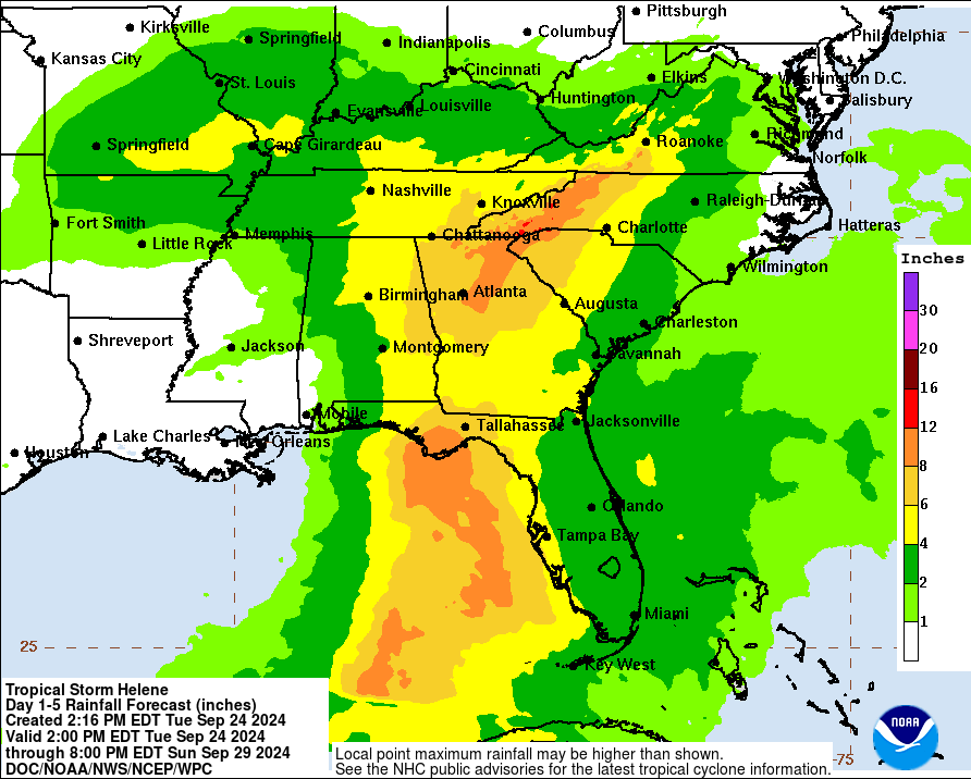
- The storm remains to our east and current forecasting has Santa Rosa County receiving 2 to 4 inches of rain.
- If the current forecast remains intact, the worst of the conditions would be far east of Santa Rosa County.
- Stay weather aware, just in case of changes in the forecast in the final few days.