Florida readies for ‘dangerous storm’
Tallahassee – Hurricane and storm-surge watches were in effect Tuesday for much of Florida’s Gulf Coast as a weather system is expected to rapidly grow into “a potentially very dangerous storm” and hit the state as a hurricane this week.

By Jim Turner
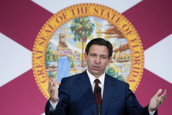
Gov. Ron DeSantis noted some uncertainty in the forecast for what is expected to become Hurricane Helene. He expanded a state of emergency to 61 of the state’s 67 counties, with only some counties in Southeast Florida excluded. DeSantis, who declared a state of emergency in 41 counties Monday, also requested a federal emergency declaration in advance of the storm making landfall.
“I think the fact that this would be forecasted as a major (hurricane) at this point without formation, shows that this has a potential to be a really, really significant storm,” DeSantis said during a news conference Tuesday morning at the state Emergency Operations Center.
The storm was on a track to make landfall in North Florida.
“The Big Bend and Panhandle should be especially prepared for a direct impact,” DeSantis said.
Both areas are in different stages of recovery from hurricanes. Hurricane Michael caused massive damage in the Panhandle in 2018 after making landfall near Mexico Beach with 160 mph sustained winds. Hurricane Idalia in 2023 and Hurricane Debby this year made landfall in Taylor County in the Big Bend region before causing damage across North Florida.
DeSantis said impacts could be felt 100 miles to 200 miles from the center of what is expected to be “a potentially very dangerous storm.”
With power outages anticipated from what was being called Potential Tropical Cyclone 9, Duke Energy Florida said it was preparing for the aftermath.
“While Potential Tropical Cyclone 9’s path and intensity are still uncertain, Duke Energy Florida is preparing to respond as quickly as possible should our customers experience any disruptions in service,” Melissa Seixas, Duke Energy Florida state president, said in a prepared statement. “We strongly encourage our customers to plan ahead for the potential impacts of the storm and use this time to ensure they have all the supplies they need to stay safe and informed.”
DeSantis said about 18,000 utility line workers are being pre-positioned. His executive order also activated 3,000 members of the Florida National Guard and the Florida State Guard.
“We are amassing significant resources to move in and restore power,” DeSantis said.
Florida Division of Emergency Executive Director Kevin Guthrie said he expects local evacuation decisions to be made Wednesday and urged Floridians to finalize preparation plans, including a full tank of gas and seven days of food and water.
The National Hurricane Center on Tuesday gave the system a “near 100 percent” chance of formation in the next 48 hours. It said Southwest Florida likely will start to feel winds from the system Wednesday as it moves north in the gulf.
“The system is expected to intensify into a major hurricane before it approaches the northeastern Gulf Coast on Thursday, and the potential for life-threatening storm surge and damaging hurricane-force winds along the coast of the Florida Panhandle and the Florida west Gulf Coast is increasing,” the hurricane center said in a Tuesday morning advisory.
With maximum sustained winds of 35 mph, the center of the system Tuesday morning was about 205 miles south-southeast of the western tip of Cuba.
A hurricane watch was in place from Englewood, at the border of Charlotte and Sarasota counties, to Indian Pass in Gulf County.
Storm surge watches were in place from Indian Pass to Flamingo, in Monroe County.
Storm surge is expected to top five feet in Tampa Bay. It is expected to reach more than 10 feet from the Ochlockonee River, which empties into the gulf south of Tallahassee, to the Chassahowitzka River near Crystal River.


